Distal Footprints
SIEF is supporting The Distal Footprints of Giant Ore Systems 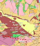
The challenge
Australia is an old continent with much of its remaining mineral endowment obscured by a thick cover of weathered rock, sediment and soil materials. This presents a critical challenge for mineral exploration now and into the future, as the industry currently lacks the fundamental data, scientific knowledge and technological tools needed to discover new, world-class ore deposits buried deep under this cover.
The response
The key to discovering new resources under cover is the ability to detect and recognise the distal footprints of deep giant ore systems. A distal footprints ‘toolkit’ will be created; this inter-related suite of tools will include know-how, methodologies, and new field and laboratory analysis techniques. This approach is unique within Australia, and the team aim to eventually provide geophysical data sets and interpretative map products across the area, a field guide to the area, an assessment of mineralogical, chemical, geophysical and geological indicators. It will bring new data, new interpretations, new understandings and new technologies to help discover mineral wealth deep under cover.
The collaboration
Aligning with the Australian Academy of Sciences UNCOVER initiative to boost exploration geosciences research in Australia, and the Federal Government’s National Exploration Strategy, the distal footprints of giant ore systems project is a collaboration between CSIRO, UWA (through the Centre for Exploration Targeting), Curtin University, and the Geological Survey of Western Australia. The Collaboration is also drawing on the expertise and industry knowledge of the ARC Centre of Excellence for Core to Crust Fluid Systems and the Minerals Research Institute of Western Australia. Industry partners are also contributing industry knowledge as well as financial support.
Projected impact
The Project is addressing key technical risks impeding future greenfield exploration:
- Assisting with developing mineral exploration technologies and processes to identify the tell-tale ‘footprints’ or
signatures of deposits under covered terrain, increasing exploration success in Australia to provide the mines of the
future. - Opening up new exploration frontiers and improving mineral exploration decision making in the Australian context to
increase exploration investment in Australia. - Gaining insight into the detection and recognition of distal footprints related to ore systems in the Capricorn region,
supporting companies exploring in the region to increase investment in the region and potential for future mining in
the Capricorn. - Data sets collected will also feed into other domains. For example the regional Airborne electro magnetic data set
may help define new groundwater resources; the mineral system approach will improve the way in which energy
exploration is conducted in covered terrains. - Developing a new generation of exploration geoscience researchers with direct experience of working with industry
on practical challenges.