Intelligent LiDAR mapping and a navigating system for drones (Hovermap)
SIEF supports intelligent LiDAR mapping and a navigating system for drones (Hovermap).
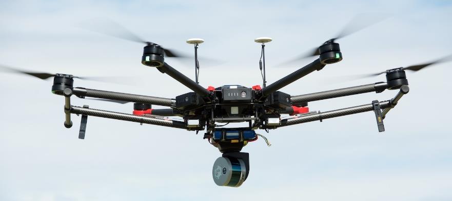
Hovermap technology making drones safer.
The challenge
While there is a global market for drone technology, the drones we currently have are ‘dumb and blind’. Drones rely on GPS navigation and so cannot sense the world around them and react accordingly. They cannot be flown autonomously indoors, underground, or close to large structures that interfere with GPS.
The response
Hovermap is software and hardware (payload) that attaches to existing drones to provide omni-directional 3D sensing and accurate LiDAR mapping. The technology helps drones avoid collision, gives drone pilots better situational information, and accurately maps the environment – all without the need for GPS. The SIEF Experimental Development Program (EDP) supported the Hovermap team to flight test the technology in real-life situations and translate current prototypes into commercial products.
The collaboration
A team from CSIRO provided hardware and software engineering support for the project.
Projected impact
The outcomes of this project allows Hovermap-attached drones to fly safely anywhere and be operated by anyone, with projected impacts including:
- Improving service quality and reducing the costs and risks of sending people into difficult terrain to inspect assets and map landscapes.
- Reducing the costs incurred by Australian companies, the community, and the government in maintaining critical facilities and infrastructure, such as power, communications, transport, water, and oil and gas. For example, more regular and easier power line inspections by drones using Hovermap technology could help prevent bushfires caused by faulty lines.
- Avoiding the damage, loss, and injuries which can occur when drones (which lack Hovermap technology) collide.
- Driving commercial growth in the international drone market, generating investment in Australian R&D and enabling new drone applications to be developed, in turn creating job growth and increased business opportunities.
Download: Intelligent LiDAR mapping and a navigating system for drones brochure [pdf · 169kb]